Landscape Photography
Lake Leelanau North Arm Aerial Photo from SW 2020
Lake Leelanau is located near Leland on the Leelanau Peninsula in Leelanau County, northwest of Traverse City on the northwest shores of Michigan's lower peninsula. This aerial photo was taken southwest of the North Arm on a summer day.
Lake Leelanau is located near Leland on the Leelanau Peninsula in Leelanau County, northwest of Traverse City on the northwest shores of Michigan's lower peninsula. This aerial photo was taken southwest of the North Arm on a summer day.
Prints are available to purchase by clicking the image above or by visiting lakes-of-michigan.com.
Lake Lansing near Lansing Aerial Photo from North
Lake Lansing is located in Haslett, just east of Lansing in Ingham County in Michigan's lower peninsula. This photo was taken north of the lake on a summer day.
Lake Lansing is located in Haslett, just east of Lansing in Ingham County in Michigan's lower peninsula. This photo was taken north of the lake on a summer day.
Prints are available to purchase by clicking the image above or by visiting lakes-of-michigan.com.
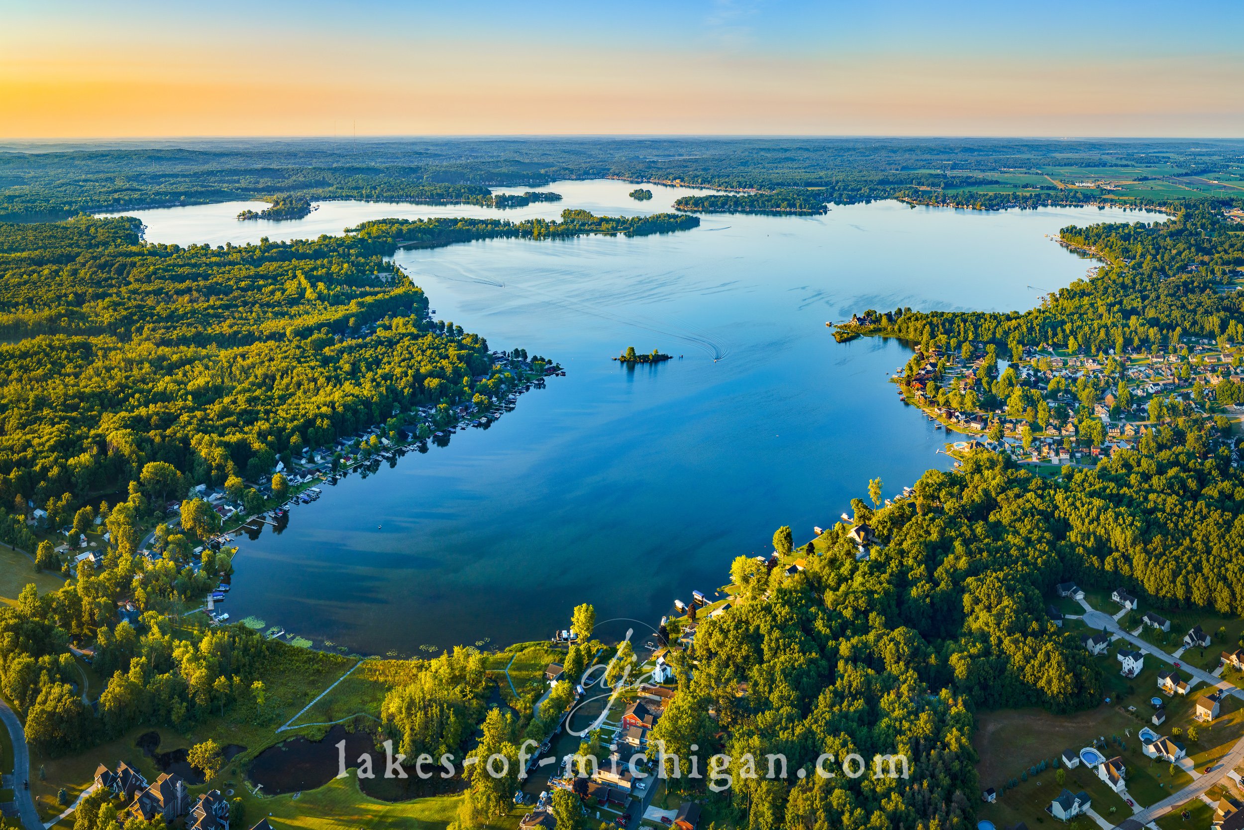
Lake Doster near Kalamazoo Aerial Photo from N
Lake Doster is located about 10 miles north of Kalamazoo in Allegan County in Michigan's lower peninsula. This aerial photo was taken on a summer evening from north of the lake.
Lake Doster is located about 10 miles north of Kalamazoo in Allegan County in Michigan's lower peninsula. This aerial photo was taken on a summer evening from north of the lake.
Prints are available to purchase by clicking the image above or by visiting lakes-of-michigan.com.
Lake Charlevoix Aerial Photo from SE in Early Fall
Lake Charlevoix is located near the northwestern shores of Charlevoix County in Michigan's lower peninsula, situated between the cities of Charlevoix and Boyne City. This aerial photo was taken southeast of the lake on an evening in early fall.
Lake Charlevoix is located near the northwestern shores of Charlevoix County in Michigan's lower peninsula, situated between the cities of Charlevoix and Boyne City. This aerial photo was taken southeast of the lake on an evening in early fall.
Prints are available to purchase by clicking the image above or by visiting lakes-of-michigan.com.
Lake Charlevoix Aerial Photo from NW 2019
Lake Charlevoix is located near the northwestern shores of Charlevoix County in Michigan's lower peninsula, situated between the cities of Charlevoix, Boyne City, and East Jordan. This aerial photo was taken northwest of the lake on a summer day.
Lake Charlevoix is located near the northwestern shores of Charlevoix County in Michigan's lower peninsula, situated between the cities of Charlevoix, Boyne City, and East Jordan. This aerial photo was taken northwest of the lake on a summer day.
Prints are available to purchase by clicking the image above or by visiting lakes-of-michigan.com.
Lake Cadillac Aerial Photo from NW
Lake Cadillac is located near the city of Cadillac near the William Mitchell state park in Wexford County in Michigan's lower peninsula. This aerial photo was taken from NW of the lake on a summer afternoon.
Lake Cadillac is located near the city of Cadillac near the William Mitchell state park in Wexford County in Michigan's lower peninsula. This aerial photo was taken from NW of the lake on a summer afternoon.
Prints are available to purchase by clicking the image above or by visiting lakes-of-michigan.com.
Lake Bella Vista near Rockford Aerial Photo from East
Lake Bella Vista is located between Rockford and Cannonsburg, northeast of Grand Rapids in Kent County. This aerial photo was taken east of the lake on a summer day.
Lake Bella Vista is located between Rockford and Cannonsburg, northeast of Grand Rapids in Kent County. This aerial photo was taken east of the lake on a summer day.
Prints are available to purchase by clicking the image above or by visiting lakes-of-michigan.com.
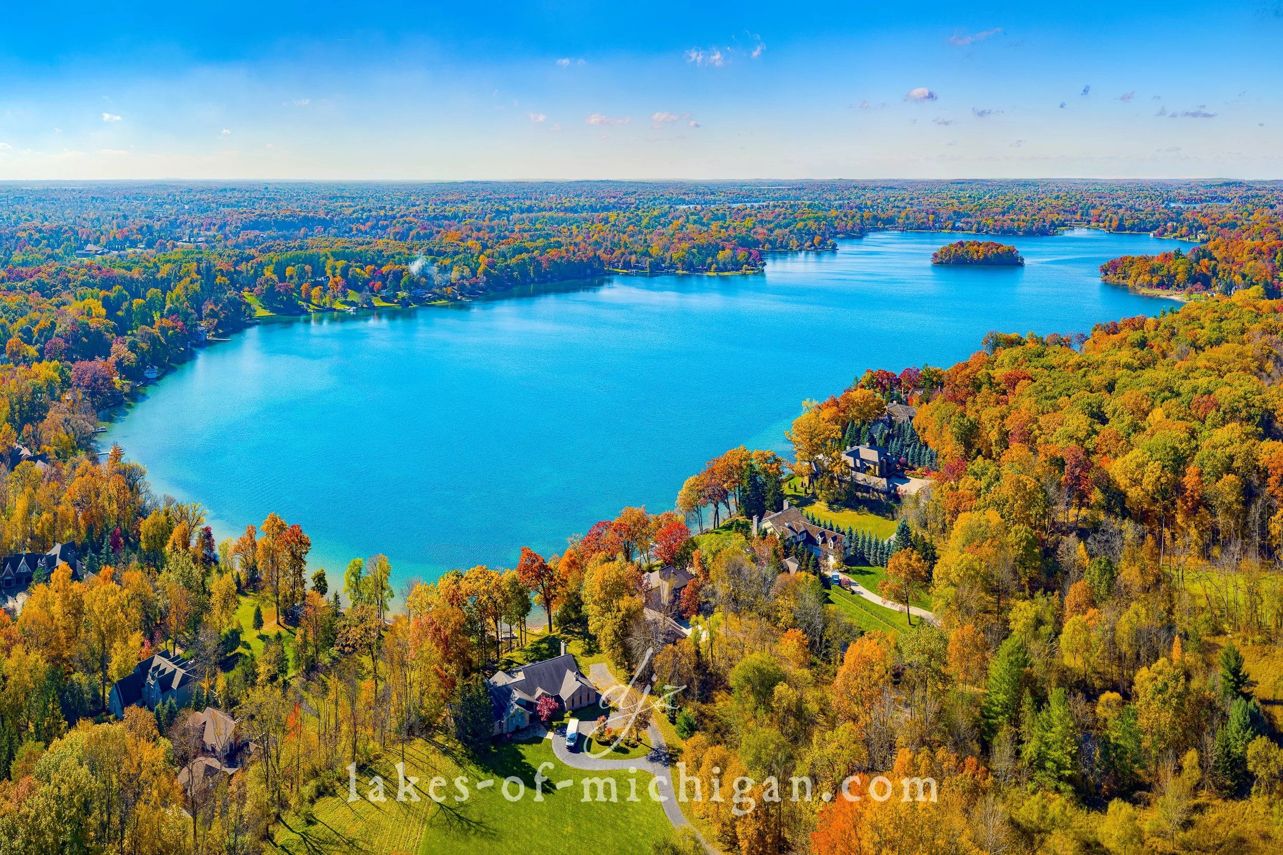
Lake Angelus near Pontiac Fall Aerial Photo from East
Located just north of Pontiac, Lake Angelus is between Auburn Hills & Waterford Township in Oakland County in Michigan's lower peninsula. This aerial photo was taken east of the lake during peak fall foliage color.
Located just north of Pontiac, Lake Angelus is between Auburn Hills & Waterford Township in Oakland County in Michigan's lower peninsula. This aerial photo was taken east of the lake during peak fall foliage color.
Prints are available to purchase by clicking the image above or by visiting lakes-of-michigan.com.
Klinger Lake near Sturgis Aerial Photo from the SW
Klinger Lake is located between Sturgis and White Pigeon, about 10 miles southeast of Three Rivers in St. Joseph County in Michigan's lower peninsula. This aerial photo was taken southwest of the lake on a summer day.
Klinger Lake is located between Sturgis and White Pigeon, about 10 miles southeast of Three Rivers in St. Joseph County in Michigan's lower peninsula. This aerial photo was taken southwest of the lake on a summer day.
Prints are available to purchase by clicking the image above or by visiting lakes-of-michigan.com.
Houghton Lake near Roscommon Aerial Photo from NW
Houghton Lake is located in Roscommon County near Roscommon just south of Higgins Lake, with Grayling to the north. This aerial photo was taken northwest of the lake on a summer morning in 2021.
Houghton Lake is located in Roscommon County near Roscommon just south of Higgins Lake, with Grayling to the north. This aerial photo was taken northwest of the lake on a summer morning in 2021.
Prints are available to purchase by clicking the image above or by visiting lakes-of-michigan.com.
Higgins Lake near Roscommon Aerial Photo from South
Higgins Lake is located near Roscommon, south of Grayling and North of Houghton Lake in Roscommon County in Michigan's lower peninsula. This aerial photo was taken south of the lake on a summer day.
Higgins Lake is located near Roscommon, south of Grayling and North of Houghton Lake in Roscommon County in Michigan's lower peninsula. This aerial photo was taken south of the lake on a summer day.
Prints are available to purchase by clicking the image above or by visiting lakes-of-michigan.com.
Higgins Lake near Roscommon Aerial Photo from North
Higgins Lake is located near Roscommon, south of Grayling and North of Houghton Lake in Roscommon County in Michigan's lower peninsula. This aerial photo was taken north of the lake on a summer day.
Higgins Lake is located near Roscommon, south of Grayling and North of Houghton Lake in Roscommon County in Michigan's lower peninsula. This aerial photo was taken north of the lake on a summer day.
Prints are available to purchase by clicking the image above or by visiting lakes-of-michigan.com.
Hardy Dam Pond near Newaygo Aerial Photo from South
The Hardy Dam and Pond are located about 10 miles NE of Newaygo and 15 miles SW of Big Rapids in Newaygo County in Michigan's lower peninsula. This aerial photo was taken on a summer evening from south of the dam.
The Hardy Dam and Pond are located about 10 miles NE of Newaygo and 15 miles SW of Big Rapids in Newaygo County in Michigan's lower peninsula. This aerial photo was taken on a summer evening from south of the dam.
Prints are available to purchase by clicking the image above or by visiting lakes-of-michigan.com.
Harbor Springs near Petoskey Aerial Photo from NE
Harbor Springs is located across from Petoskey on the north side of Little Traverse Bay in Emmet County in Michigan's lower peninsula. This aerial photo was taken on a hot & humid summer morning from northeast of the harbor.
Harbor Springs is located across from Petoskey on the north side of Little Traverse Bay in Emmet County in Michigan's lower peninsula. This aerial photo was taken on a hot & humid summer morning from northeast of the harbor.
Prints are available to purchase by clicking the image above or by visiting lakes-of-michigan.com.
Hamlin Lake near Ludington Aerial Photo from South
Hamlin Lake is located along Ludington State Park on the western shores of Mason County in Michigan's lower peninsula. To the west of Hamlin Lake along the shores of Lake Michigan, you can enjoy the Ludington State Park Beach or hike the Lighthouse Trail to Big Sable Point Lighthouse. This aerial photo was taken on a summer morning from south of the lake.
Hamlin Lake is located along Ludington State Park on the western shores of Mason County in Michigan's lower peninsula. To the west of Hamlin Lake along the shores of Lake Michigan, you can enjoy the Ludington State Park Beach or hike the Lighthouse Trail to Big Sable Point Lighthouse. This aerial photo was taken on a summer morning from south of the lake.
Prints are available to purchase by clicking the image above or by visiting lakes-of-michigan.com.
Gun Lake near Wayland Aerial Photo from West Summer Sunrise
Gun Lake is located near Wayland, Shelbyville, and Martin, about halfway between Grand Rapids and Kalamazoo in Michigan's lower peninsula. This aerial photo was taken from west of the lake before sunrise on a summer morning.
Gun Lake is located near Wayland, Shelbyville, and Martin, about halfway between Grand Rapids and Kalamazoo in Michigan's lower peninsula. This aerial photo was taken from west of the lake before sunrise on a summer morning.
Prints are available to purchase by clicking the image above or by visiting lakes-of-michigan.com.
Gun Lake near Wayland Aerial Photo from NW
Gun Lake is located near Wayland, Shelbyville, and Martin, about halfway between Grand Rapids and Kalamazoo in Allegan and Barry Counties in Michigan's lower peninsula. This aerial photo was taken northwest of the lake on a summer morning.
Gun Lake is located near Wayland, Shelbyville, and Martin, about halfway between Grand Rapids and Kalamazoo in Allegan and Barry Counties in Michigan's lower peninsula. This aerial photo was taken northwest of the lake on a summer morning.
Prints are available to purchase by clicking the image above or by visiting lakes-of-michigan.com.
Gull Lake near Delton Aerial Photo from SE
Located near Hickory Corners and Richland, Gull Lake is about 10 miles northeast of Kalamazoo and 5 miles south of Delton in Barry and Kalamazoo Counties in Michigan's lower peninsula. This aerial photo was taken southeast of the lake in early fall.
Located near Hickory Corners and Richland, Gull Lake is about 10 miles northeast of Kalamazoo and 5 miles south of Delton in Barry and Kalamazoo Counties in Michigan's lower peninsula. This aerial photo was taken southeast of the lake in early fall.
Prints are available to purchase by clicking the image above or by visiting lakes-of-michigan.com.
Gull Lake near Delton Aerial Photo from NW
Located near Hickory Corners and Richland, Gull Lake is about 10 miles NE of Kalamazoo and 5 miles south of Delton in Barry and Kalamazoo Counties in Michigan's lower peninsula. This aerial photo was taken northwest of the lake on a summer day.
Located near Hickory Corners and Richland, Gull Lake is about 10 miles NE of Kalamazoo and 5 miles south of Delton in Barry and Kalamazoo Counties in Michigan's lower peninsula. This aerial photo was taken northwest of the lake on a summer day.
Prints are available to purchase by clicking the image above or by visiting lakes-of-michigan.com.
Green Lake near Caledonia Aerial Photo from SW
Located between Caledonia and Moline, Green Lake is south of Grand Rapids in Allegan County in Michigan's lower peninsula. This aerial photo was taken from southwest of the lake on a summer afternoon.
Located between Caledonia and Moline, Green Lake is south of Grand Rapids in Allegan County in Michigan's lower peninsula. This aerial photo was taken from southwest of the lake on a summer afternoon.
Prints are available to purchase by clicking the image above or by visiting lakes-of-michigan.com.


