Landscape Photography
St Jospeph Lighthouses at Night - Long Exposure with Boat Lights
This is a long exposure of the St. Joseph Lighthouses taken at night with boats passing by, creating light trails across the photo.
This is a long exposure of the St. Joseph Lighthouses taken at night with boats passing by, creating light trails across the photo.
Prints are available to purchase by clicking the on the image above or by visiting lakes-of-michigan.com.
Mission Point Lighthouse near Traverse City Aerial Photo from North - 2021
This is an aerial photo of the Mission Point Lighthouse near Traverse City taken on a summer day in 2021.
This is an aerial photo of the Mission Point Lighthouse near Traverse City taken on a summer day in 2021.
Prints are available to purchase by clicking the on the image above or by visiting lakes-of-michigan.com.
Frankfort North Breakwater Lighthouse with Full Moon - May 16th, 2022
This photo of the Frankfort North Breakwater Lighthouse was taken as the full "Flower Moon" was perfectly centered behind the top of the lighthouse during blue hour in May of 2022. (Single exposure)
This photo of the Frankfort North Breakwater Lighthouse was taken as the full "Flower Moon" was perfectly centered behind the top of the lighthouse during blue hour in May of 2022. (Single exposure)
Prints are available to purchase by clicking the on the image above or by visiting lakes-of-michigan.com.
St Joseph Lighthouses Long Exposure Photo at Tiscornia Park Beach
This is a long exposure of the St Joseph North Pier Inner and Outer Lighthouses taken from the beach at Tiscornia Park.
This is a long exposure of the St Joseph North Pier Inner and Outer Lighthouses taken from the beach at Tiscornia Park.
Prints are available to purchase by clicking the on the image above or by visiting lakes-of-michigan.com.
White Lake near Whitehall and Montague Aerial Photo from NE - Fall Colors
White Lake is situated near Whitehall and Montague, about 10 miles north of Muskegon on the western shores of Muskegon County in Michigan's lower peninsula. This aerial photo was taken during peak fall foliage color from northeast of the lake.
White Lake is situated near Whitehall and Montague, about 10 miles north of Muskegon on the western shores of Muskegon County in Michigan's lower peninsula. This aerial photo was taken during peak fall foliage color from northeast of the lake.
Prints are available to purchase by clicking the on the image above or by visiting lakes-of-michigan.com.
Holland Big Red Lighthouse in Morning with Full Moon Setting - April 16th, 2022
This photo of the Holland Big Red Lighthouse was taken as the full moon was setting into Lake Michigan on the morning of April 16th, 2022.
This photo of the Holland Big Red Lighthouse was taken as the full moon was setting into Lake Michigan on the morning of April 16th, 2022.
Prints are available to purchase by clicking the on the image above or by visiting lakes-of-michigan.com.
Holland Big Red Lighthouse at Night with Full Moon - April 16th, 2022
This photo of the Holland Big Red Lighthouse was taken under the light of the full moon during blue hour on the morning of April 16th, 2022.
This photo of the Holland Big Red Lighthouse was taken under the light of the full moon during blue hour on the morning of April 16th, 2022.
Prints are available to purchase by clicking the on the image above or by visiting lakes-of-michigan.com.
Grand Haven Lighthouse with the Full Moon on April 15th 2022
This photo of the Grand Haven South Pier and lighthouses was taken on April 15th, 2022 as the full moon was setting over Lake Michigan.
This photo of the Grand Haven South Pier and lighthouses was taken on April 15th, 2022 as the full moon was setting over Lake Michigan.
Prints are available to purchase by clicking the on the image above or by visiting lakes-of-michigan.com.
South Haven Lighthouse and Moonset - April 14th 2022
This photo of the South Haven Lighthouse and setting moon is a blend of two photos taken 15 minutes apart with my camera holding position on a tripod on the morning of April 14th, 2022.
This photo of the South Haven Lighthouse and setting moon is a blend of two photos taken 15 minutes apart with my camera holding position on a tripod on the morning of April 14th, 2022.
Prints are available to purchase by clicking the on the image above or by visiting lakes-of-michigan.com.
Lake Columbia near Brooklyn Aerial Photo from North with Fall Colors
Lake Columbia is located just west of Brooklyn about 11 miles SSE of Jackson in Jackson county in Michigan's lower peninsula. This aerial photo was taken on a fall morning from north of the lake during peak fall foliage color.
Lake Columbia is located just west of Brooklyn about 11 miles SSE of Jackson in Jackson county in Michigan's lower peninsula. This aerial photo was taken on a fall morning from north of the lake during peak fall foliage color.
Prints are available to purchase by clicking the on the image above or by visiting lakes-of-michigan.com.
Wamplers Lake near Brooklyn, Michigan - Aerial Photo from SE
Wamplers Lake is located near Brooklyn about 17 miles southeast of Jackson in Jackson and Lenawee Counties in Michigan's lower peninsula. This aerial photo was taken from southeast of the lake on a fall afternoon during peak fall foliage color.
Wamplers Lake is located near Brooklyn about 17 miles southeast of Jackson in Jackson and Lenawee Counties in Michigan's lower peninsula. This aerial photo was taken from southeast of the lake on a fall afternoon during peak fall foliage color.
Prints are available to purchase by clicking the on the image above or by visiting lakes-of-michigan.com.
Traverse City Aerial Photo from Northwest
This aerial photo of Traverse City was taken from northwest of the city over the waters of the West Arm of the Grand Traverse Bay on a sunny afternoon.
This aerial photo of Traverse City was taken from northwest of the city over the waters of the West Arm of the Grand Traverse Bay on a sunny afternoon.
Prints are available to purchase by clicking the on the image above or by visiting lakes-of-michigan.com.
Frankfort North Breakwater Lighthouse at Night with Boat Lights
This photo is a blend of multiple long exposures taken from the Elberta Bluffs Lake Michigan Overlook that captured boats heading into the Frankfort Harbor and Betsie Lake for the night.
This photo is a blend of multiple long exposures taken from the Elberta Bluffs Lake Michigan Overlook that captured boats heading into the Frankfort Harbor and Betsie Lake for the night.
Prints are available to purchase by clicking the on the image above or by visiting lakes-of-michigan.com.
White Lake Piers near Whitehall Aerial Photo from West
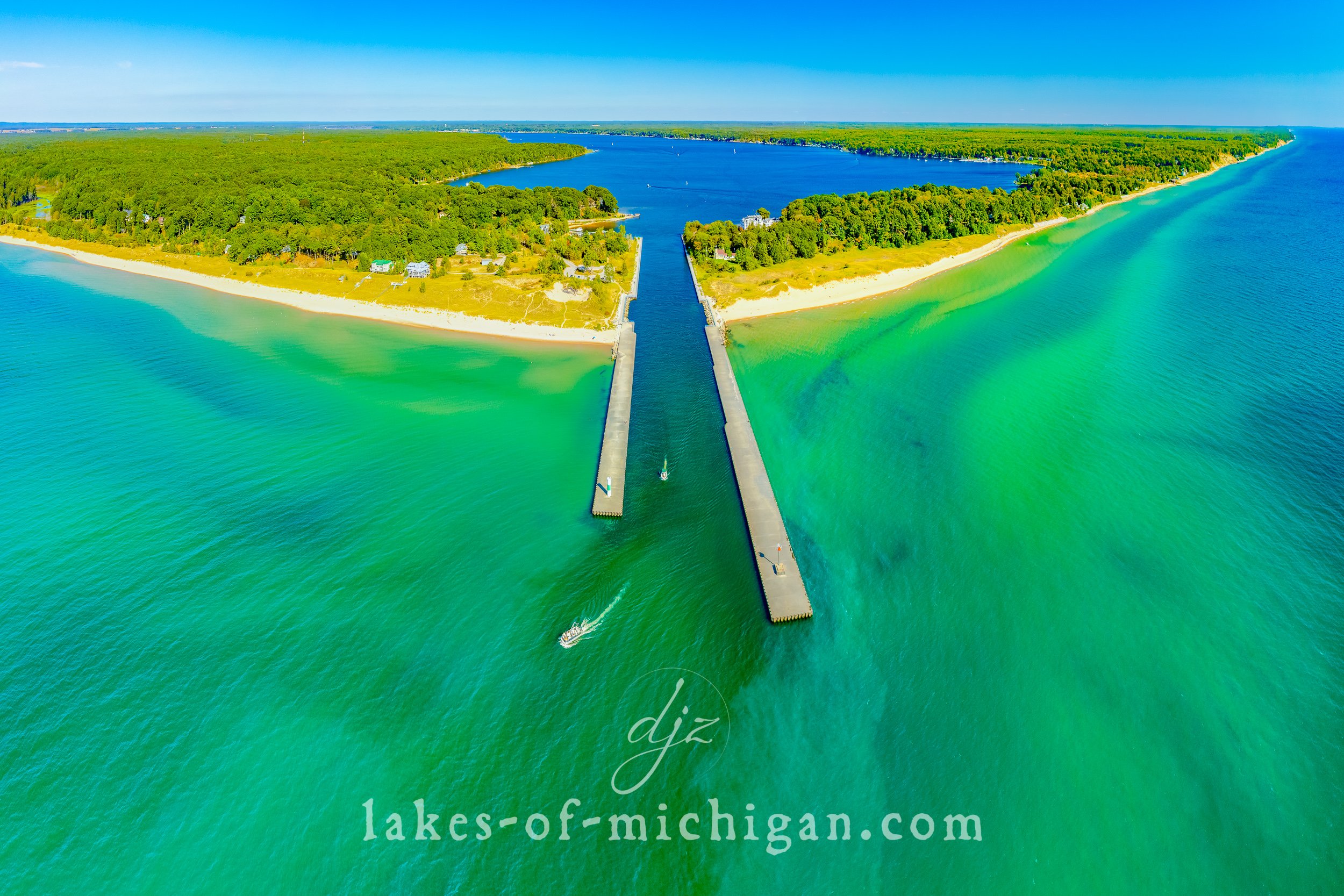
White Lake is situated between Whitehall and Wabaningo, about 10 miles north of Muskegon on the western shores of Muskegon County in Michigan's lower peninsula. This aerial photo was taken from west of the piers and White River Light Station on a summer afternoon.
White Lake is situated between Whitehall and Wabaningo, about 10 miles north of Muskegon on the western shores of Muskegon County in Michigan's lower peninsula. This aerial photo was taken from west of the piers and White River Light Station on a summer afternoon.
Prints are available to purchase by clicking the on the image above or by visiting lakes-of-michigan.com.
Silver Lake in Mears Aerial Photo from North
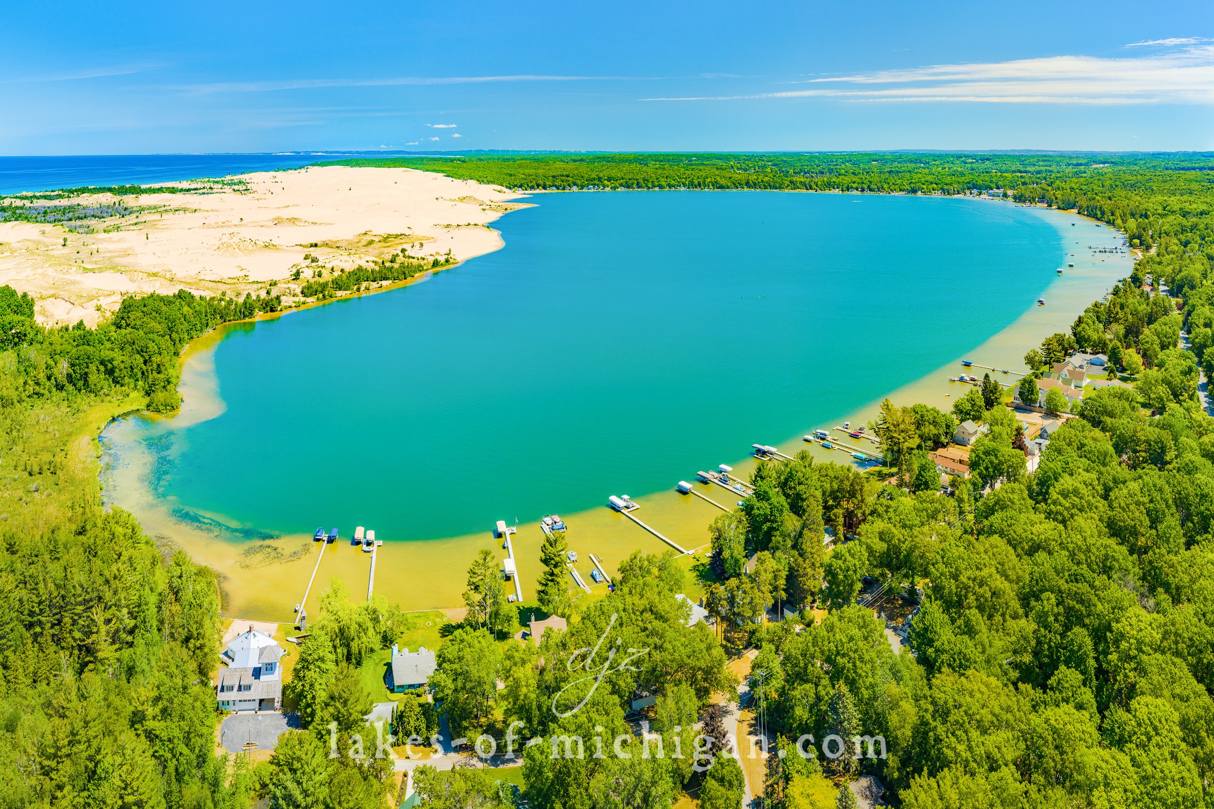
Silver Lake is located near Mears in Oceana County along the western shores of Michigan's lower peninsula. This aerial photo was taken from north of the lake and features the dunes of Silver Lake State Park and Lake Michigan on the right.
Silver Lake is located near Mears in Oceana County along the western shores of Michigan's lower peninsula. This aerial photo was taken from north of the lake and features the dunes of Silver Lake State Park and Lake Michigan on the right.
Prints are available to purchase by clicking the on the image above or by visiting lakes-of-michigan.com.
Duncan Lake near Caledonia Aerial Photo from South - Fall Colors
Located near Caledonia and Middleville, Duncan Lake is south of Grand Rapids in Barry County in Michigan's lower peninsula. This aerial photo was taken from south of the lake during peak fall foliage color in 2021.
Located near Caledonia and Middleville, Duncan Lake is south of Grand Rapids in Barry County in Michigan's lower peninsula. This aerial photo was taken from south of the lake during peak fall foliage color in 2021.
Prints are available to purchase by clicking the image above or by visiting lakes-of-michigan.com.
Silver Lake and Dunes in Mears Aerial Photo from South
Silver Lake is located near Mears in Oceana County along the western shores of Michigan's lower peninsula. This aerial photo was taken from south of the lake and features the dunes of Silver Lake State Park and Lake Michigan on the left.
Silver Lake is located near Mears in Oceana County along the western shores of Michigan's lower peninsula. This aerial photo was taken from south of the lake and features the dunes of Silver Lake State Park and Lake Michigan on the left.
Prints are available to purchase by clicking the on the image above or by visiting lakes-of-michigan.com.
Lake Charlevoix South Arm with Ironton Ferry Aerial Photo from Northwest
The South Arm of Lake Charlevoix stretches more than 7 miles between Ironton and East Jordan in Charlevoix County in Michigan's lower peninsula. This aerial photo was taken from northwest of the lake as the Ironton Ferry brings its passengers to the west side of the south arm.
The South Arm of Lake Charlevoix stretches more than 7 miles between Ironton and East Jordan in Charlevoix County in Michigan's lower peninsula. This aerial photo was taken from northwest of the lake as the Ironton Ferry brings its passengers to the west side of the south arm.
Prints are available to purchase by clicking the on the image above or by visiting lakes-of-michigan.com.
Mullett Lake near Indian River Aerial Photo from Southwest
Situated between Cheboygan and Indian River, Mullett Lake is about 20 miles south of the Mackinac Bridge at the north end of Michigan's lower peninsula. This aerial photo was taken on a summer evening from southwest of the lake in 2021.
Situated between Cheboygan and Indian River, Mullett Lake is about 20 miles south of the Mackinac Bridge at the north end of Michigan's lower peninsula. This aerial photo was taken on a summer evening from southwest of the lake in 2021.
Prints are available to purchase by clicking the on the image above or by visiting lakes-of-michigan.com.
Kalamazoo Lake near Saugatuck and Douglas Aerial Photo with Fall Colors
Kalamazoo Lake is located along the Kalamazoo River between Saugatuck and Douglas in Allegan County in Michigan's lower peninsula. This aerial photo was taken from southeast of the lake during peak fall foliage colors.
Kalamazoo Lake is located along the Kalamazoo River between Saugatuck and Douglas in Allegan County in Michigan's lower peninsula. This aerial photo was taken from southeast of the lake during peak fall foliage colors.
Prints are available to purchase by clicking the image above or by visiting lakes-of-michigan.com.


